By Jack Phillips
Hurricane Idalia made landfall along Florida’s Big Bend region as a Category 3 storm on Wednesday morning, according to the U.S. National Hurricane Center (NHC) in an update. The storm now moving northward, and its center is located over the southern portion of Georgia.
Federal officials said the storm, which intensified into a Category 4 storm overnight but was downgraded, specifically made landfall near Keaton Beach, along the Apalachee Bay, at around 7:45 a.m. ET. As it hit, the maximum sustained winds were 125 mph, or very close to a Category 4 system.
The storm, as of Tuesday at 11 a.m., had been downgraded to a Category 1 storm with 90 mph winds. The center of Idalia at that time was crossing into a small section of southern Georgia as it moves northward, according to the NHC.
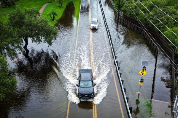
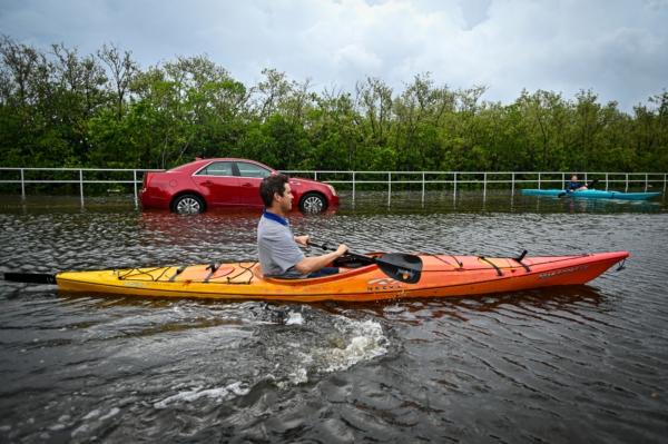
More than 263,000 customers were without electricity as rushing water covered streets near the coast. As the eye moved inland, destructive winds shredded signs, sent sheet metal flying, and snapped tall trees. Downed power lines closed northbound Interstate 75 just south of Valdosta, Georgia.
Earlier, the NHC wrote that Hurricane Idalia’s eye had brought “catastrophic storm surge” and damaging winds. Notably, the storm is moving relatively quickly, moving to the north-northeast at about 18 mph.
Forecasters said it would punish the Carolinas overnight as a tropical storm. Some models predicted Idalia could circle southward toward land again after that, but the National Hurricane Center forecast it to move deeper into the Atlantic this weekend.
Video footage from Keaton Beach posted on social media platform X, or Twitter, by storm chaser Sidney Grimmett showed heavy downpours and trees whipping in the wind as an electrical line sparked along the side of a roadway.
“Water levels along the coast of the Florida Big Bend are rising rapidly. A NOAA National Ocean Service tide gauge at Cedar Key, Florida, recently reported a water level of 5.9 feet above mean higher high water, which is an approximation of inundation in that area,” the NHC said.
And it also warned that storm “surge-related flooding depends on the relative timing of the surge and the tidal cycle and can vary greatly over short distances,” according to a recent update.
Damage from storm surge may span about 200 miles along the Florida Gulf Coast, past the Tampa Bay area, according to the NHC. The Big Bend area, meanwhile, could receive 12 to 16 feet of storm surge.
The National Weather Service office’s in Tallahassee warned that some “locations may be uninhabitable for several weeks or months” due to wind and storm surge damage.
Even though the storm was downgraded to a Category 3, it’s still a “major” hurricane under the Saffir-Simpson hurricane wind scale and NHC’s guidelines. “Devastating damage will occur,” according to the Saffir-Simpson scale, adding that a Category 3 system has winds of 111 to 129 mph, and can still cause “major damage” to “well-built framed homes.”
“Many trees will be snapped or uprooted, blocking numerous roads,” it says, noting that “electricity and water will be unavailable for several days to weeks after the storm passes.”
Some analysts noted that Hurricane Idalia is the most powerful storm to make landfall along the Big Bend region, which historically doesn’t see a lot of hurricane activity, in 127 years. A hurricane in 1896 hit the region with 125 mph winds.
“Don’t put your life at risk by doing anything dumb at this point. This thing’s powerful,” Gov. Ron DeSantis said at a news briefing in Tallahassee that was interrupted for a few seconds by a power cut.
According to the tracking website Poweroutage.us, well over 300,000 customers in Florida and Georgia are currently without power. The majority is located in Suwanee, Taylor, Lafayette, Dixie, and Wakulla counties in Florida, the map shows.
Most of Florida’s 21 million residents, and many in the adjacent states of Georgia and South Carolina, were under hurricane warnings and other storm-related advisories. State emergency declarations were issued in all three.

Meanwhile, Florida’s Gulf Coast, southeastern Georgia, and eastern parts of North and South Carolina could face 4 to 8 inches of rain through Thursday, with isolated areas seeing as much as a foot of rain, the U.S. Hurricane Center warned. Officials said the storm’s most dangerous feature would be a powerful surge of wind-driven surf that is expected to flood barrier islands and other low-lying areas along the coast.
The governors of North Carolina, South Carolina, Georgia, and Florida have already declared emergencies over the storm’s potential impacts. The Biden administration on Monday approved Florida’s request for a pre-landfall emergency declaration, while the state’s emergency operations agency is operating at 24-hour capacity.
“If you end up with a storm surge that even approaches 16 feet, the chances of surviving that are not great,” Mr. DeSantis said. “You would need to be in a three-story building because it is going to rise very, very high.”

At the White House on Tuesday, President Joe Biden said he and Mr. DeSantis, who is seeking the Republican nomination to challenge the president in the 2024 election, were “in constant contact” about storm preparations. The president was set to speak about the government’s hurricane response efforts later on Wednesday.
About 5,500 National Guard members were mobilized, while 30,000 to 40,000 electricity workers were on standby. The state has set aside 1.1 million gallons of gasoline to address interruptions to fuel supplies, the governor said.
On Tuesday, the U.S. Federal Aviation Administration (FAA) said that it “may pause flights in and out of” the Tampa airport as it moves to re-route aircraft and “closing Gulf routes” due to Hurricane Idalia.
Reuters and The Associated Press contributed to this report.


