By T.J. Muscaro
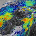
Fears of tornadoes and flooding continue to rise for states and communities in post-Tropical Cyclone Beryl’s path.
Several tornadoes are possible across the lower Ohio Valley on July 9 and July 10.
According to the National Hurricane Center (NHC), areas that could be affected include parts of Ohio, Kentucky, southeast Missouri, northwest Tennessee, southern Illinois, and southern Indiana.
The persistent tornado threat comes after scores of warnings and sightings were reported across east Texas, northwest Louisiana, Arkansas, and Mississippi over the past 24 hours.
As of 10:15 a.m. (CT), a tornado warning is in effect for the Mississippi cities of Farmington, Burnsville, and Glen.
A flood watch has been issued for northern Arkansas, central and southern Missouri, Illinois, western Kentucky, northern Indiana, and southern Michigan.
The National Water Prediction Service is already reporting moderate to major flooding on the stretch of the Mississippi River that borders Illinois, Missouri, and Iowa.
Heavy rainfall of two to four inches is expected to stretch from Missouri to the Great Lakes into July 10.
Beryl is set to bring rain to northern New York and New England on July 10.
National Oceanic and Atmospheric Administration radar indicates the rain bands are stretching to Lake Michigan and Lake Erie.
According to the National Hurricane Center’s (NHC) 10 a.m. advisory on July 9, Beryl has maximum sustained winds of around 30 mph and has increased its ground speed significantly from yesterday, moving northeast at 25 mph.
It is expected to slow as it eventually moves into Canada, and little change in the storm’s strength is expected over the next 48 hours.
Beryl has been designated a post-tropical cyclone due to its losing strength, however, the NHC warns that post-tropical cyclones can still be dangerous.
The hurricane center stated in its late-morning advisory: “Flash flooding and risk of tornadoes remain possible.”
Beryl’s journey is now in its twelfth day. It emerged in the Atlantic Ocean as a tropical depression on June 28 and grew into a Category 5 storm with 160 mph winds by the morning of July 2.
It pushed across the southern Caribbean, hitting the windward islands, Jamaica, and the Cayman Islands before crossing over Mexico’s Yucatan peninsula on July 5 as a Category 2 hurricane.
Eleven people across the Caribbean and Mexico have been reported killed.
Beryl entered the Gulf of Mexico as a tropical storm but regained hurricane strength before hitting southeast Texas on July 8 with sustained winds of 80 mph, storm surge, and torrential flooding.
In a 1 p.m. press briefing on July 8, acting Gov. Dan Patrick, Sen. Ted Cruz (R-Texas), and Emergency Management Chief Nim Kidd confirmed the U.S. death toll due to Beryl was now up to seven, including two Texans who perished due to carbon monoxide poisoning.
More than 2.7 million people were also reported to be without power.
Persistent flooding and power loss are expected to continue in Houston and the rest of southeast Texas for the next few days.


